G1 - Sentiero Geologico Urbano di Isnello
G1 - Sentiero Geologico Urbano di Isnello
Introduction
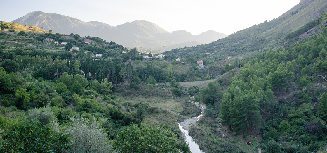
This city tour was built to enhance the Gorge of Isnello; the nearby geological site represents an important river deepening phenomenon, which followed Madonie hydrographic network evolution. The Isnello stream waters action created this "narrow path" by acting on Panormide Platform dolomitic limestone rocks, during the Upper Triassic and Early Jurassic. The "Gorge" separates the village from Pizzo Dipilo massif highest areas and its walls are characterized by steep detritus cones, which arose from the carbonate rocks disintegration due to exogenous agents. Along the path, near the valley, several fault planes are visible; this demonstrates the deformation processes that these rocks have undergone in relation to the existing areal morphology. Along the S.P. to Gibilmanna, after the bridge that crosses the stream mentioned above, can be found some modest traces of the ancient riverbed as testimony of the old river path.
The trail
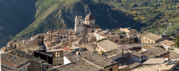
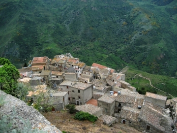
This urban geological trail philosophy is that of emphasizing the strong link between rock and man in the Madonie and particularly in Isnello; for this purpose , it integrates a city walking tour with its periphery excursion so that people during their walk also magically meet mountain landscapes; therefore, it is natural to refer to the past choices of locating the "old town" in a place geomorphologically suitable for human settlement. The site, in fact, was already provided with natural defenses and water, very important for the community maintenance and development.
Observation and resting points
The path, from its starting point, leads to the medieval castle ruins where you can enjoy a breathtaking view; from here, passing by the Chiesa di Santa Maria Maggiore and San Michele (visitable on request), through the old Isnello town, you reach the "Gola" where, in addition to significant natural views, can be observed: beautiful fault planes (fractures in rocks, affected by rock masses shifts) and the river natural course, which characterizes the landscape, creeping into the narrow gorge.? The limestone-dolomite rocks excavation produced by the torrent shaped the shrinkage, in the walls of which, on the left bank, are visible peculiar detritus accumulations (various sized stones and gravel) due to the rock fragmentation because of the freeze-thaw alternation combined with the surface erosion.