579 - Sentiero dei pellegrini
Vote: 3.6
579 - Sentiero dei pellegrini
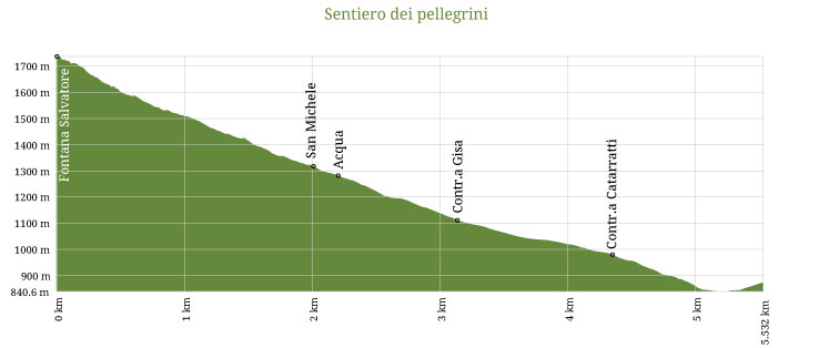
From the saddle at 1780 meters above sea level, beside the fountain, you'll take the trail rapidly descending with loads of hairpin turns along the valley "della Cella" and reaches at 1290 meters above sea level, the small road "Regia Trazzera 284" that crosses the "Contrada Gisa" area, near the centuries-old "Ash of Puntaloro" and reaches the river Imera Meridionale at 835 meters above sea level.
Crossed the river, the road with an ascending stretch covered by pavement, reaches the state road 120 at 890 m.a.s.l., crosses it and through a paved street reaches the Petralia Sottana center at 990 m.a.s.l.

Nature
Landscapes and Geology
Spirituality
Points along the trail
Santuario Madonna dell'Alto
The shrine of Madonna dell'Alto (Mother of the Height), built at over 1800 meters above...

Trail lenght: 5 Km and 649 meters
Journey time: 3 Hours
Return Journey time: 2 Hours
Trailhead elevation: 1780 m/slm
End of the trail elevation: 990 m/slm
Recommended seasons: Autumn | Spring | Summer
Difficulty: E


