561 - Sentiero Portella Colla - Case Disiceddi (Piano Cervi)

561 - Sentiero Portella Colla - Case Disiceddi (Piano Cervi)
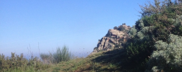
Moving out the gathering point, you will immediately come into contact with Madonie territory unique characteristics. Along the dirt track, where the stream that runs alongside has strongly carved the earth, you can observe a Numidian Flysch rock outcrop, very important from a geological and sedimentologic point of view. The succession, in fact, is characterized by little thick layers made of clays and dark colour silty clays (from brown to greenish grey). Within these, the layers of dark anthracite colour are composed of iron carbonate, characterized by a high specific weight, alternating with layers of even 50 cm thick, characterised by small fossils presence; to observe these fossils is necessary to use a magnifying glass (nummulites and other foraminifer, rudista mollusc, gastropods and algae fragments).
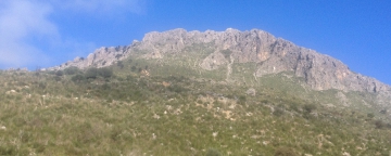
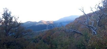
Resuming the march, on a short descent, you can see a typical Basilisk (Cachrys ferulacea) area, overlooking the surrounding land vegetation during the spring. This herbaceous plant dead roots, form the substrate where the basilisk mushroom grows (Pleurotus nebrodensis), very well appreciated and popular in Madonie local cooking. However, being in the Park "A" zone, it is forbidden to pick up these mushrooms. Continuing on the trail, after passing the State lands entrance gate, the beech forest characterizes the landscape surrounding the path. Inside this forest, located on Cozzo Piombino slopes, there is an Abies nebrodensis implantation, made by the Forestry at the end of seventies, as an attempt to repopulate this area with such an important species. Even if the latest interventions carried out under the LIFE Nature Project, have opened new perspectives for this species preservation and conservation (whose population is composed of only 30 specimens), It still remains at risk of extinction. At the end of the ascent, at an elevation of 1,530 mt above sea level, the hiker will see wide open Fluvial-Karst depression, which has a small glacial lake in the middle created by the thawing snow, called Piano Cervi. Here the grassland takes the place of the beech woods that, however, dominates unopposed all the North West area of the plateau, where it forms a complex and lush beech forest. Such things give this place the typical appearance of the high mountains, in which intense and complex landscapes are among the most evocative that the Park can offer to its visitors. Continuing along the trail over the plain immersed in the beech forest, and after observing some coal mines, which gives us the opportunity to contemplate the ancient charcoal craft, the visitors will arrive to the C.A.S. shelter where they will be able to stop for a while and regain their strength. Alongside this shelter, the Forestry Agency built a thatched shelter for educational purposes, following the traditional building technique, which is now on the brink of an irreversible collapse.
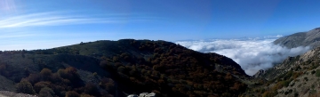
Now visitors can continue toward Valle della Giumenta until reaching Mandria Nipitalva, through a path rich of scenic spots among the most unusual and exciting of the whole Madonie district. Mandria Nipitalva, inserted in the homonym valley, is a classic "sharp" mountain where shepherds, during spring and summer, are still today involved in pastoralism, producing the typical Madonie Provola and the famous "basiliscu" ricotta. Both products are now to be considered among the niche products, as well as, slow food products. Continuing downstream, the tour can be concluded in a place where visitor will enjoy some landscapes of absolute value and amenities; here, from the superb oak forest that clings on Pizzo Carbonara cliffs, passing through the Montaspro mesophilous oaks and Pizzo Dipilo prairies, the panorama extends to the Gulf of Termini and, even, to Mongerbino. The large "cliff" that line Monte Cervi north side are not less spectacular.


.jpg)